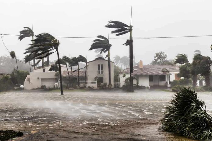
A Category 2 hurricane slammed into Florida’s Panhandle near Destin with 105-mph winds, flooding streets and knocking out power to large swaths of the region.
Story Snapshot
- Category 2 landfall near Destin brought 105-mph winds and widespread power outages.
- Heavy rain and storm surge flooded roads and coastal areas across the Panhandle.
- Reports described toppled trees, damaged roofs, and debris across beach communities.
- Officials warned of flash, urban, and river flooding even as the storm moved inland.
Landfall Details and Wind Damage
Reporters and officials said the storm made landfall near Destin on Friday evening as a Category 2 hurricane with top sustained winds near 105 miles per hour. The location sits on the western Florida Panhandle, about 40 miles east of Pensacola. The strong winds toppled trees, tore parts of roofs, and scattered debris across beach roads. Power outages spread as lines came down and equipment failed under stress. Crews began restoration even as winds stayed gusty overnight.
News updates described signs ripped from posts, boats shifted by surge and waves, and broken fencing along waterfronts. Reporters on scene described howling gusts that forced them to brace to stand. These effects match what Category 2 winds can do to weak roofs, siding, and shallow-rooted trees. Officials and forecasters had tracked a long stretch of the northern Gulf Coast for life-safety risks tied to wind, surge, and heavy rain through the night.
Flooding Risks: Surge, Rain, and Inland Threats
Forecasters warned of life-threatening flash flooding and fast-rising coastal water as the storm moved ashore. Rainfall of four to eight inches, with higher local amounts, was expected across the Panhandle. Coastal highways and low-lying neighborhoods took on water during peak winds and tides. Inland, rivers and creeks faced rises that could continue after the center passed. Officials urged drivers to avoid flooded roads and to watch for hidden washouts.
The Pensacola region and nearby communities faced combined hazards. Storm surge pushed into bays and sounds while bands of rain trained over the same areas. That setup can overwhelm drains and ditches. The National Hurricane Center and state officials highlighted a risk of considerable flash, urban, and river flooding. That risk can last into the next day as runoff drains toward the coast, even after winds weaken and skies begin to clear.
Where It Hit and Why That Matters
Destin and Fort Walton Beach sit on narrow barrier islands and bays where wind direction and timing can worsen flooding. When a strong hurricane lands just west or east of these spots, water can funnel into passes and sounds. That can flood roads and ground-level homes. The New York Times placed the landfall near Destin and set the scene for nearby communities, including those east of Pensacola, to experience the worst winds and surge during the evening peak.
🌪️ HURRICANE ISAIAS HITS FLORIDA — AT LEAST TWO DEAD AS THOUSANDS LOSE POWER
Hurricane Isaias struck Florida on Friday evening as a Category 2 hurricane, causing widespread damage across the southeastern United States.
At least two people have died after trees fell onto their… pic.twitter.com/iCIVmPPGNR
— benny 🇩🇰 🇫🇴 🇬🇱 🇪🇺 🇺🇦 (@benny0692698414) October 10, 2026
Local recovery priorities now focus on power, debris, and safe water. Utility crews must clear lines and replace damaged gear before restoring service fully. Emergency teams will check bridges, causeways, and beach roads for erosion and structural damage. Residents are urged to use generators outdoors and to treat dark intersections as four-way stops. Leaders will update on shelter status, school closures, and re-entry rules as assessments come in.
How to Read the Coverage Without the Hype
Major outlets described a clear timeline: a Category 2 landfall near Destin, intense winds, and widespread flooding and outages. That framing reflects what people on the ground saw and what agencies warned about. At the same time, disaster research shows that storm footage often gets mixed online, which can blur when and where images were taken. Readers should rely on official updates and named reports to track which hazards apply to their street, not just the region.